February 2005
By Reinhard Zollitsch
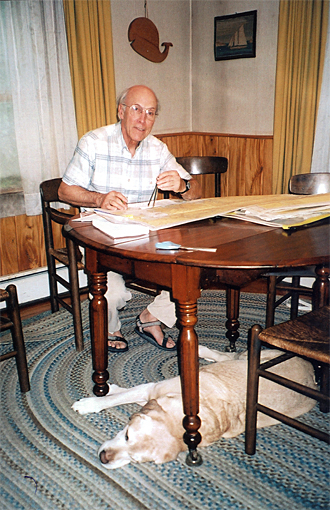
Careful trip planning (RZ at home)
Last May , my two sons offered to give me a GPS for my 65th birthday and retirement. A big thanks! But I am sorry to say I turned it down and instead accepted a compact, deck-mounted, high-tech lensatic passive radar reflector.
On the one hand I was touched by their concern for my safety on my solo canoe travels along the Atlantic coast, while at the same time noticing their attempt to update the old guy and propel him into the twenty-first century. On the other hand I was somewhat apprehensive about the new-fangled thing and a bit leery about all I would have to learn to make this little waterproof gadget work for me.
I soon found out that I would have to buy a lot of software for it, for each area between $ 100 and $ 200. (And I thought my charts were expensive at $20 a shot! My canoe trips usually cover hundreds of miles across many different areas.)
The experts at WEST Marine then pointed out that I unfortunately could not program the new GARMIN with my i-Mac (APPLE computer), and that I would need a charger, and plug in my GPS regularly or bring along a lot of AA batteries. I had to laugh picturing myself looking for a plug-in on one of those god-forsaken islands I normally go to on my 2-3 week trips.
I must say, though, that I was impressed with all the features, but the screen was distinctly too small for a guy wearing reading glasses. I would have to mount it just outside my cockpit rim, where I would have a hard time seeing and reaching it. I have pointed out before that one should not plan on using a hand-held compass or now GPS on an always moving and surging ocean. They have to be mounted; you need your hands for the paddle.
And what about the glare of the sun? It would make the screen impossible to read, at least some of the time. And did I really want to be told at all times how fast I was going, etc. etc.? It suddenly reminded me of being in a race or in my terribly connected office, both of which I wanted to escape from.
But it wasn’t really all that which made me turn down the kind offer. I am good in figuring things out, I love my I-Mac, I surf the web for all kinds of info, send e-mails all over the place, use a satellite phone on my longer trips (for brief outgoing calls only!) and love my high-tech Kevlar and carbon fiber boats and paddle.
No, I am not a stick-in-the-mud and do not mind changing my old ways. I also do not scare easily, and definitely would not allow a little box like that to intimidate me. It was none of the above. I was simply afraid a GPS would change not just my way of navigation but my entire way of life on the water: my attitude.
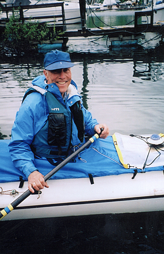
Charts, compass & stopwatch always right at hand...
Accepting a GPS into my boating life would be much more than getting an air horn instead of a whistle, a hand pump instead of a bailer. Whether I was navigating in the thick-o’-fog around Nova Scotia, ticking off one point after the other with my NOAA charts, compass and stopwatch mounted in front of me, or making out a specific island or passage in a bay, like Mahone Bay or the Bay of Islands, it has always been a thrill for me to figure out where I was and to get to my destination.
Finding out that I had even compensated correctly for wind drift and tide set and that I was even right on time, has always been extremely elating. I often burst out in a loud “YES!”, encouraging myself to go on to meet the next challenge.
NOAA charts are like literature for me. I read and study them very carefully before my trip even starts, and review each stretch for the following day. I take note of the shoreline for wind protection and for possible take-outs, and am aware of all ledge outcroppings where the tide could break or develop a rip.
If necessary, I even memorize a good stretch if the tide forces me to be on the water before sunrise. (Is that ever exciting, being out on the ocean at 4:00 a.m. Atlantic time, as well as immensely rewarding, hitting all way points as planned, in the semi-dark, and all from memory!)
I am in no way downplaying the immense progress GPS has made in navigation. Skippers can now know at all times where they are precisely, down to a couple of feet. They can see their speed, their drift, their entire course - I am duly impressed, don’t get me wrong.
But for me in my little solo hand-propelled boat it was never important to be told where I was, because I knew that already. I was never lost, not along the foggy Fundy shore nor in the Nightmare or the Shark River Delta in the Everglades. My point has always been, never to allow myself to get lost, at least not completely.
Each point, island or bight ahead is like a quest or challenge for me, both mentally as well as physically. Traveling from point A to point B on the map is not nearly as important as how I get there, how I figure out the puzzle.
Using the age-old art of dead reckoning, navigating with chart, compass and watch, is an art I hate to see lost. It is my mental challenge and is equally as important as the physical challenge of being out there on the ocean all alone in a 17 foot sea canoe.
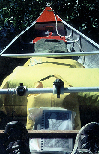
...even in the Florida Everglades
If we lose the art of dead reckoning, I am afraid we lose more than “an outdated navigation system”, we lose an attitude, the skill of taking in and evaluating all the information given by the surroundings, plus some basic time-distance calculations. Being able to pinpoint where you are is nice, but simply not enough. Dead reckoning for me is a complex learning process, taking in and evaluating all the information given on the chart, the Coast Pilot and in nature, rather than just looking at a tiny dot on a mini screen.
Just knowing where you are is like a kayaker saying that he has learned the eskimo roll in last winter’s pool session. Having to execute it successfully on the cold Atlantic, in wind and waves with a laden boat, unassisted, is a completely different story. Being skilled enough to stay up, or even better, avoiding getting into situations where you would have to rely on your roll, is even better.
I in my sea canoe (which, by the way, cannot be rolled completely around because of the large cockpit design) have to make sure not to make a mistake and flip. I am therefore oh-so-alert and quick as well as practiced to prevent such a situation, or at least recover quickly from an almost-dump.
The same is true with getting lost. I don’t get lost, because I cannot afford to. It is an attitude of mine now. Some small boaters with GPS, on the other hand, don’t seem too concerned about that, because they can get an instant fix at any time, so they think; so why worry. But when their batteries run low or the whole thing acts up - and I have seen that more than once - they are in serious trouble unless they have also kept track of their course on a paper chart.
On the other hand, I have seen sea kayakers being so mesmerized by their new gizmo that they forget to appreciate where they are and why they are out there. They remind me of compulsive readers at a foreign movie, who feel they have to read every last subtitle instead of watching the real thing, the movie. When I go boating, I am not out for a “virtual paddle”, but the real thing with all its trimmings - challenges and hardships, but also rewards.
A paper chart in a tied-down waterproof case along with a good deck-mounted compass will never fail you, and working out your fixes on your own is as gratifying as working out a math problem all by yourself, rather than copying the correct answer from a friend and fudging the rest. For small boaters, dead reckoning should be the main navigational system, with GPS as an optional backup.
In commercial navigation it is definitely the other way around. Nobody would argue against that. Small boaters, I feel, should not want to miss the intellectual stimulus and challenge of figuring out all the different factors that go into the equation. It keeps me curious and sharp. I guess I have always hated to be given answers, but would much rather arrive at them in my own way. I have always wanted to know what is in an answer, i.e. study and understand the forces and variables that go into it.
So far I have done quite well at that, and am looking forward to future challenges, like closing the last 490-mile-gap between Boston and Lake Champlain this summer. That would finally complete my circumnavigation of New England and the Maritimes which I started on Lake Champlain in 1999 (see Rounding the Gaspé in the May 2000 issues of MAIB). I’ll keep you posted, if you like.
© Reinhard Zollitsch
BACK TO TOP OF PAGE